- ホーム
- English Website
English Website
About Us
We work together with local communities for " River Basin Development "
In Japan, MLIT is responsible for river basin management in major parts of large water systems (class A rivers) like Rokkakugawa and Matsuuragawa rivers through local MLIT offices of River, while prefectural governors are responsible for the rest part of class A rivers and the other water systems (class B rivers).
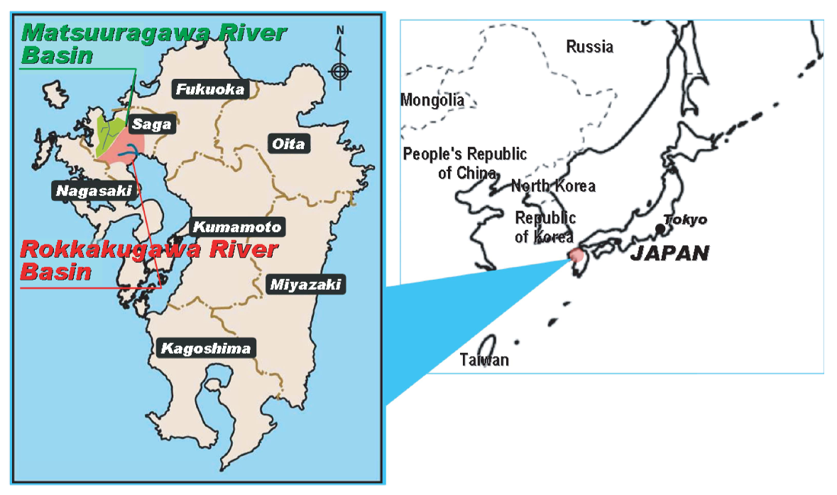
MLIT Takeo River Office is responsible for river basin management in two basins which flow through Saga Prefecture in the west part of Kyushu Island. One is Rokkakugawa river Basin (the 32-kilometer-Rokkakugawa river, the 23-kilometer-Ushizugawa river and the 1.6-kilometer-Takeogawa river) which flow into the Ariake Sea inland. Another is Matsuuragawa River Basin (the 30-kilometer-Matsuuragawa river, the 14-kilometer-Tokusuegawa river, the 14-kilometer Kyuragigawa river including Kyuragi Dam) which flow into the Sea of Genkai.
Location

Overview of our activities
We seek comprehensive management of Rokkakugawa and Matsuuragawa rivers, by trying to prepare for and respond to flooding caused by heavy rain or high tide water, to facilitate the use of rivers, to improve and protect the river environment. We also support local communities not only through maintaining or managing the flood control facilities like levees, sluices, water gates and the drainage pomp in the Rokkakugawa and Matsuuragawa rivers and Kyuragi Dam, but also through communicating and working together for "River Basin Development" harmonized with rich ecosystem, river landscape, history and culture.
Because of the geographical background of Saga Plain, which is famous for lowland area, people in this floodplain are so enthusiastic about flood management that quite numbers of communities have taken part in flood hazard mapping. The characteristics of their mapping can be seen in the map which covers not only flood hazards but also daily emergency information.
Last updated on Fubruary 24, 2011.
Contact Info
Takeo Office of River, MLIT
745 Showa, Takeo-cho, Takeo, Saga 843-0023 JAPAN
E-mail : takeo@qsr.mlit.go.jp
Copyright (C) 武雄河川事務所.All Rights Reserved.