- ホーム
- English Website
- What weve done & What we do
- Integrated Flood Management Training for Flood Hazard Mapping, collaborated with JICA and ICHARM on 8-9 February 2011
Integrated Flood Management Training for Flood Hazard Mapping, collaborated with JICA and ICHARM on 8-9 February 2011
The Training Workshop on Integrated Flood Management (IFM) for Flood hazard Mapping was held in Takeo, Japan, from 8 to 9 February 2011. The training course was organized by JICA/ICHARM, in collaboration with UNESCO-IHE and MLIT Takeo River Office.
Background:
Flood Hazard Mapping is one of the most effective and practical tools toward Integrated Flood Management (IFM), which has been instrumental in defining what role a flood plays in the development process of societies, and what the sustainable flood management options are. Considering the situation in Asia, JICA and ICHARM organized a training course for practitioners in flood management and planned to hold a training workshop in the field. Saga Plain, where is located in Kyushu Island of Japan, 1,000 kilometer west from Tokyo, is famous for lowland area and ecologically rich wetland, Ariake Sea. Because of its geographical background, people in this floodplain are so enthusiastic about flood management that quite numbers of communities have taken part in flood hazard mapping. The characteristics of their mapping can be seen in the map which covers not only flood hazards but also daily emergency information, such as location of hospitals or fire pools. This is why MLIT Takeo River Office was selected as the field of the training workshop. The workshop was developed to familiarize participants from Asian countries with the flood hazard mapping in the context of community or land use planning. It provided participants with in depth views of the various dimensions of flood hazard mapping and will allow them to develop an integrated perspective on floods, floodplains and development process in their own countries.
Facilitators:
Masahiko Murase (MLIT)
Toshiaki Anai (MLIT)
Tsuyoshi Komuta (MLIT)
Marie Kurihara (MLIT)
Seiki Iizuka (JICA)
Hideo Yamashita (ICHARM)
Frank van der Meulen (UNESCO-IHE)
Participants:
| SONAM LHAMO | Geologist, Department of Geology and Mines, Ministry of Economic Affairs, Bhutan |
| Phuntsho Pelgay | Geologist, Department of Geology and Mines, Ministry of Economic Affairs, Bhutan |
| Joko Mulyono | Head of Section: Sub Directorate of Dam, Directorate of River, Lake and Reservoir, Directorate General of Water Reservoirs, Indonesia |
| PHOUTHANOXAY Sengduangduan |
Technical Staff, Department of Meteorology and Hydrology, Water Resources Environment and Administrator, Lao PDR |
| TIN Yi |
Assistant Director / Hydrology Division, Department of Meteorology and Hydrology, National Hydrological Centre, Ministry of Transport, Myanmar |
| DWIVEDI Shreekamal | Engineering Geologist / Dept of Water Induced Disaster Prevention, Planning Section. Ministry of Irrigation, Nepal |
| RAMAY Muhammad Aleem Ul Hassan |
Deputy Director / Hydrogist in Charge of FFWS / National Weather Forecasting Centre / Flood Forecasting and Warning System (FFWS) for Lai Nullah Basin, Pakistan Meteorological Department, Pakistan |
| ABEYSIRIWARDENA Dharmasena |
Chief Irrigation Engineer / Specialise Services Sub Department, Irrigation Department, Sri Lanka |
| BOKHTARII Sayyod | Cartographer / Information Management and Analytical Center, Committee of Emergency Situation and Civil Defence, Tajikistan |
| TIABJARIYAWAT Singhanat |
Policy and Plan Analist, Professional Level/ Strategies and Management Division, Department of Disaster Prevention and Mitigation, Ministry of Interior, Thailand |
| Md. Saiful Hossain | Executive Engineer, Directorate of Planning-3, Bangladesh Water Development Board, Bangladesh |
| Ika Yulianti | Staff of data and Information section, Balai Besar Wilayah Sungai Bengawan Solo, Indonesia |
Course objectives:
- Familiarize participants an overview on the floodplain, Saga plain and its problem related to flooding, the floodplain, the development process, and the role of Flood hazard Mapping in the context of Integrated Flood Management (IFM),
- Provide participants an opportunity to think on the mapping to address the issue of floods in their own context,
- Compare and present the effects and limits of traditional flood management options to the integrated approaches,
- Provide participants an opportunity to share their conceptions and ideas with water/disaster managers from other countries, and
- Equip participants with knowledge about available tools and methodologies for the mapping to improve their flood management practices in their areas of responsibility.
Duration:
1.5 days / 11 hours including field survey
Audience:
Flood manager, Engineer etc.
Training results:
After completing the workshop participants should:
- Understand the rationale for applying an flood hazard mapping under IFM concept,
- Understand the merits and challenging aspects of flood hazard mapping and critically review them within their own country context,
- Understand various flood management measures (structural and non-structural measures),
- Identify requirements and possible actions within their own backgrounds that would apply flood hazard mapping, and
- Organize similar mapping activities facilitate such actions in their own context.
Conclusions and Way Forward:
The participants raised the issues and discussed on the following points:
- The relation between the geographical /social backgrounds and activity for flood hazard mapping,
- The advantage on combining flood hazard mapping and the other activities, such as land use planning or daily emergency mapping,
- The challenging aspects on financial and institutional resources to continue and support these activities,
- The driving forces for various institutions and sectors arrangement that are necessary for IFM approaches through hazard mapping,
- The opportunity for the participants from various backgrounds in Asian countries to share and exchange views on the flood management and mapping in practices,
- The tools, documents and training materials during the workshop which can be effective to apply flood hazard mapping in their own countries, and
- The participants’ appreciation for the facilities and services provided by MLIT which made the workshop successful.
Workshop program
1st DAY--14:00-17:00, Tuesday, 8 February 2011
Training workshop
- Opening remarks (Tsuyoshi Komuta, MLIT)
- New Contingency Plan (Marie Kurihara, MLIT)

- Approaches taken with Local Communities “Development of a Disaster Prevention Community” (Marie Kurihara, MLIT)
*Activities Brochure : What will your town start with ?

- Residents’ Evacuation Activities at the Time of a Disaster (Tsuyoshi Komuta, MLIT)
- Voluntary Disaster Prevention Activities in Tachibana-cho, Takeo City (Toshiaki Anai, MLIT)
- General discussion
SiteTrip
- Non-structural approach to flood, Information Facilities (Yoshiyasu Yano, MLIT)
- Structural approach to flood, Asahi Pumping Station (MLIT)
2nd DAY--9:00-17:00, Wednesday, 9 February 2011 -Field Survey
- Environmental Management Field (Azame-no-se)
- Kyuragi Dam (Ryoichi Kawabata, MLIT)
- Retarding Pond in Rokkakugawa Basin (MLIT)

* Training Materials are attached.
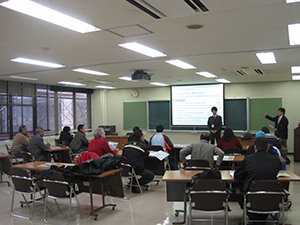
Some Pictures for the Workshop
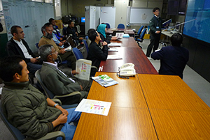 Training workshop (Day 1) |
 Information Facilities (Day 1) |
* Training Agencies website
"Local Emergency Operation Plan with Flood Hazard Map" by JICA and ICHARM
Copyright (C) 武雄河川事務所.All Rights Reserved.